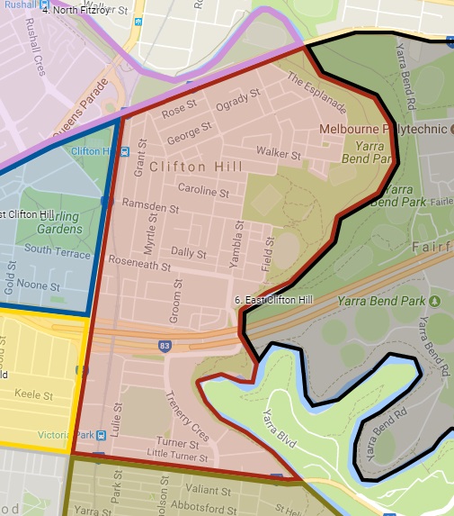
East Clifton Hill is designated as Council’s Local Area Place Making (LAPM) precinct #6, bounded by the Yarra River, Heidelberg Road, Hoddle Street, Johnston Street and Merri Creek.
Context
Residents of East Clifton Hill have been raising issues of traffic since at least the year 2000.
The East Clifton Hill LAPM area is ranked #1 on Councils LAPM priority list. LAPM reviews are a once in a decade opportunity to persuade Council to invest decent money in infrastructure such as a 30 km/h zone, better footpaths, bicycle paths, trees, pocket parks or street closures.
Schools
East Clifton Hill hosts the Spensley Street Primary School and Walker Street Community Kindergarten, attracting students from throughout the neighbourhood.
Contact us if you’d like to be the Streets Alive Yarra champion for safe routes to Spensley Street Primary or Walker St. Kindergarten.
Traffic Overview: North of Eastern Freeway
East Clifton Hill is bounded by Johnson and Hoddle Streets, Heidelberg Road and Merri Creek. These major roads become congested in peak hours forcing some passing traffic onto routes through the local traffic area of East Clifton Hill. These routes often start or end at Trenerry Crescent and lead to increased car traffic in the local area, difficulties for vulnerable road users and congestion at the north end of Fenwick Street and under the railway bridge in Roseneath Street. Road bumps, one way streets, blocked streets and roundabouts are some of the measures in place to control and slow traffic through this part of Clifton Hill
Clifton Hill train station is a great asset for the area, and trains from both the Mernda and Hurstbridge lines stop there. It attracts passengers from the local district for commuting, school trips and attending AFL matches on weekends. The station is a busy hub for pedestrians, cars and bike traffic with passenger’s cars often parked in neighbouring streets and cars dropping off and picking up passengers at all times of day.
Feedback
Your local champion, Steve Nurse, is collecting feedback from residents. You can contact Steve at cesnur(the at symbol)iimetro.com.au. Ideas and suggestions are shown on this page.
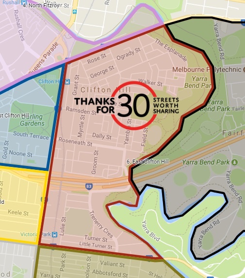
30 km/h superblock
One way to improve place making and active transport is to convert the whole of East Clifton Hill into a 30 km/h zone or superblock.
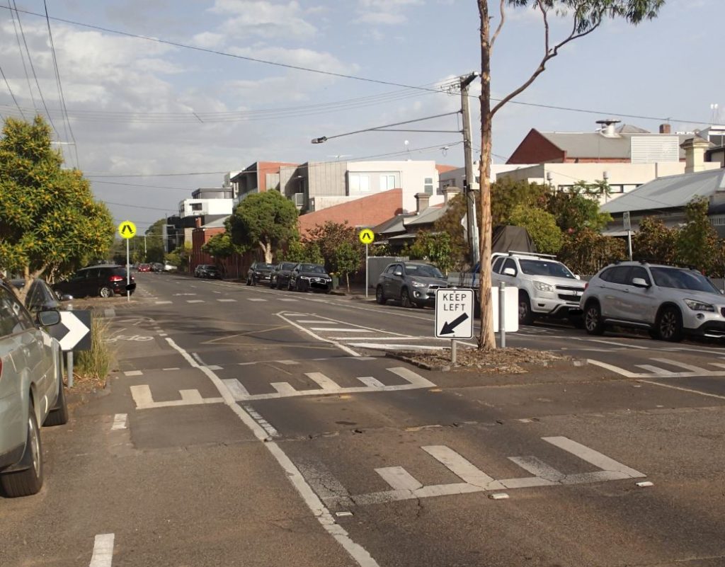
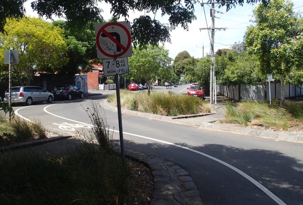
Roseneath Street Crossing near Clifton Avenue
Recently there has been a lively discussion on the Clifton Hill Good Karma Network facebook page about this Roseneath Street crossing. It was initiated by KK who has been nearly hit by a car on the crossing 3 times and has complained to council. The images below show that there could be some issues with the crossing from the motorist’s perspective. Motorists are forced to slow down for a speed hump and nature strip 20m west of the crossing and could see the separate crossing as an extra problem they are not encouraged to respect. Extending the nature strip beyond the crossing to the East could improve the general SLOW DOWN! messages. The City of Yarra has better designed pedestrian crossings and champions one of them here.

Left turn ban in Berry Street
GW writes :”We live on the the end of Berry Street near Heidelberg Road and have cars speeding by every morning despite the no left turn. It has been years since I have seen a police officer stopping people. ” Berry Street is being used as a “rat run” or motorist shortcut through the suburb to avoid other more lengthy main road alternatives. Berry St. is not well designed to slow down traffic. An increase in the width of the strips in the centre of the street could narrow the traffic lanes enough to slow traffic.
Railside Land near Roseneath Street
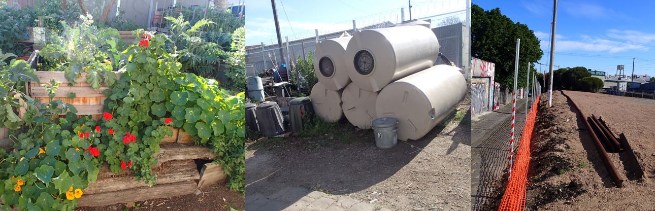
Between Gordon Street and the railway line is a triangle of derelict land. It is littered with railway steel, compact discs, cement and corrugated iron and the soil is routinely poisoned to kill weeds. Sections of the land are raised up from the surrounding lanes, and the retaining walls and fences are falling into disrepair. The picture from Google Maps shows the land as green in less-recently poisoned times!
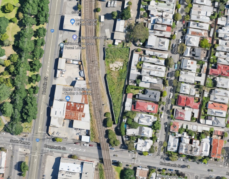
A small indication of what this land could become is right next to the railside land: the small community Laneway Garden is thriving. It would be a wonderful outcome if some of the derelict land could become community gardens as well.
However besides whatever administration issues exist and the need to repair retaining walls, herbicide would certainly be present in the soil. It might be hard but not impossible. The land is large enough to be divided into smaller sections which could be rehabilitated one parcel at a time. The narrow part of the land near Roseneath seems like the hardest to fix, at least in terms of the retaining walls which are highest and closest together there. At the moment spraying the land is a regular expense, it would be great if these funds could be diverted to rehabilitation. A few years ago the Laneway Garden received a sustainability award. To set the scene I’ve taken a few photos in the area, and overlaid them on a google map. I like the way some of the retaining wall posts (ex power poles) still have the insulators and wires on them. Some of the steel poles on the site could form part of new walls.

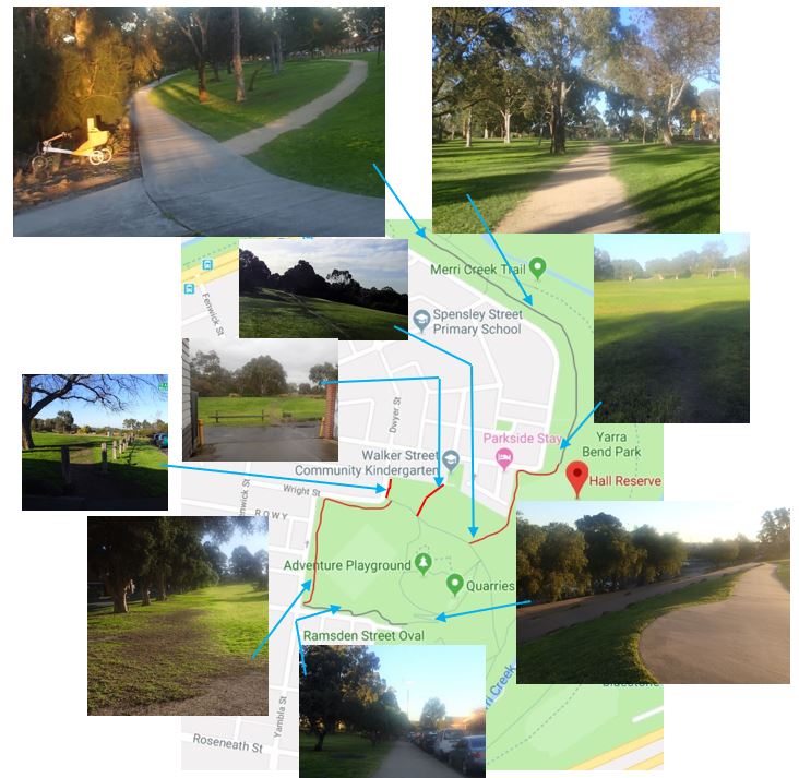
Walking Paths in Hall Reserve
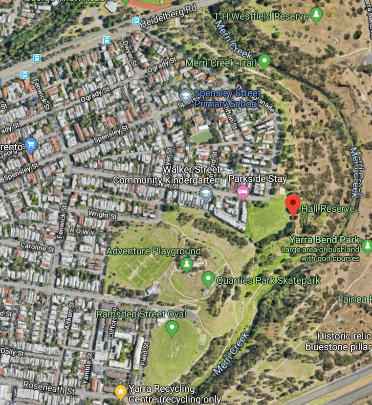
A linear park runs down the whole of the west side of Merri Creek from Roseneath Street to Heidelberg Road. The park includes Hall Reserve and has good bike paths for competent adult riders, with the main route next to Merri Creek. This bike path provides access from the Yarra River through to the Merri Creek path in Darebin. For walkers and families with children though, the paths are a bit patchy.
Families with small children would use the park as a safe enjoyable route to the Spensely St. School and Walker St Kindergarten given adequate bike or walking paths. Family and school traffic include kids on bikes, scooters, prams and walking school buses, and other potential traffic includes wheelchair and walking frame users. North of Walker St. , paths are great for the walk to school, but to the south there are missing sections of path preventing walking, disability and family access. This forces families onto neighbouring footpaths which can be too narrow and tricky. Here are some quotes from local residents:
From MJ: . I feel lucky to be in this pocket but there is more we could do to have better streets for pedestrians and people on bikes. ……… Paving bike paths around Hall Reserve so you can ride continuously through the park without the uphill and downhill of existing bike path. Lots of opportunities!
From WG: The linear park section…please don’t pave. Serious commuting cyclists have the walking/riding route closer to river. Alternatively they have the road/bike paths. Lots of people walk along here to avoid speeding cyclists plus it is a dog off leash area.
From RS: I love all the paths that you have proposed and I would add one more – there is a goat track running from the back of Walker Street Kindergarten to the main bike path through Quarries. This is a well-used, often muddy path by dog walkers, cyclists and families heading to and from Spensley Street Primary, and would be much better if it were either gravelled or sealed. Also the small gap between the log barriers where the goat track joins the laneway behind the kindergarten also needs to be widened so that bikes (including wider, Copenhagen style bikes, or those with bike trailers) can get through easily.
From MJ: The other “desire path” I’d like to see added is to connect the lane way next to walker st kinder with the park.
From ZM: This section of Yambla (between Ramsden and Wright st) is very busy with families and kids to and from school. The footpath however along this part of the street is very narrow and tricky to walk. As a parent of a preschool aged kid, we are often walking with scooters or a bike, and it is not possible to ride easily along this route. Also, in some parts the poles get in the way making it impossible to walk beside my child holding their hand. It would be great for the council to consider widening this footpath.
Proposed new gravel paths are shown in red in the above image:
- From the corner of Yambla and Ramsden to the corner of Dwyer and Wright. This section of path would let families avoid the narrow footpath on Yambla Street and the long circuitous route via the Quarries Playground.
- From the path near the Quarries Playground to the existing path near the end of Wright Street. This is a used route as evidenced by the muddy goat track created by repeated use by walkers.
- New gravel path or extension of footpath to connect Dwyer St. footpath with Hall reserve footpath at the south end of Dwyer St. This would formalise an existing goat track.
- New gravel path from the back of Walker St. Kindergarten to existing concrete paths, covering an existing goat track.
Stakeholders for these proposed pathways include the school and kindergarten, walkers, wheelchair users, families, dog walkers and soccer clubs. The new paths would not be intended as paths for experienced bike riders who are well served by other on- and off- street paths.
Yambla and Gray Streets
Introduction
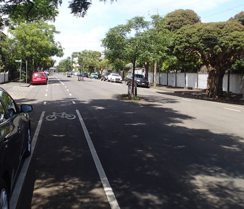
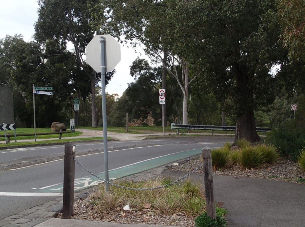
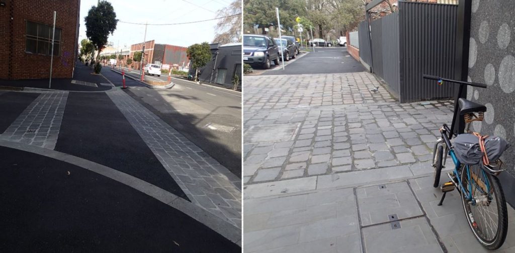
Yambla St connects with Trenerry Crescent via Gray St, making it one of the busiest routes through and into East Clifton Hill. It is a one way street for cars allowing Northbound traffic only, but is two way for cyclists. It is in 2 sections, the south section between Roseneath and Ramsden, and the north section between Ramsden and Wright. This section of the website will eventually cover all of Yambla and Gray Streets but I am starting with the North part of Yambla.
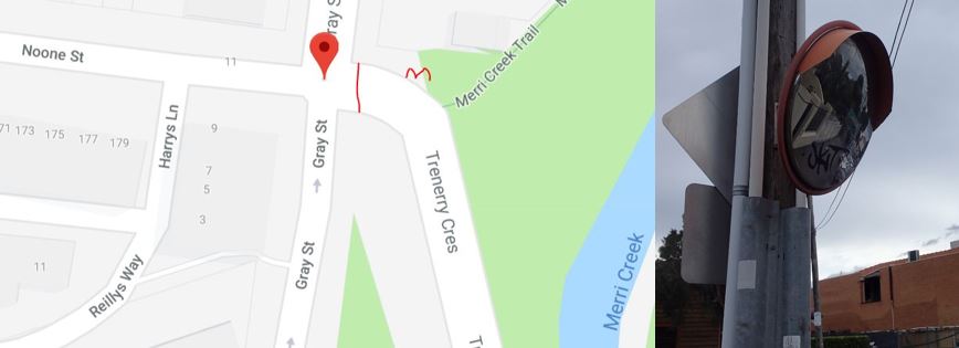
Gray Street
At the south end of Gray Street is the intersection with Noone Street and Trenerry Crescent. Beyond this intersection, Gray is a low traffic one way access road with traffic able to go North. KC writes about this intersection:
“Just getting in touch responding to your FB post about the east Clifton hill LAPM. would installation of a traffic mirror come under your proposals? I’d love to see a traffic mirror installed on the corner of Noone St and (I think it’s) Grey St, as I find when crossing from south side Noone St to the beginning of the footpath that goes down to Dights Falls it is very hard to see if cars are coming around that corner. Not sure if I’m explaining it right, but I’ve often thought one of those convex mirrors would help to “see” cars coming around the corner. The footpath heading down to Dights falls could also use some attention as it’s pretty uneven in places “
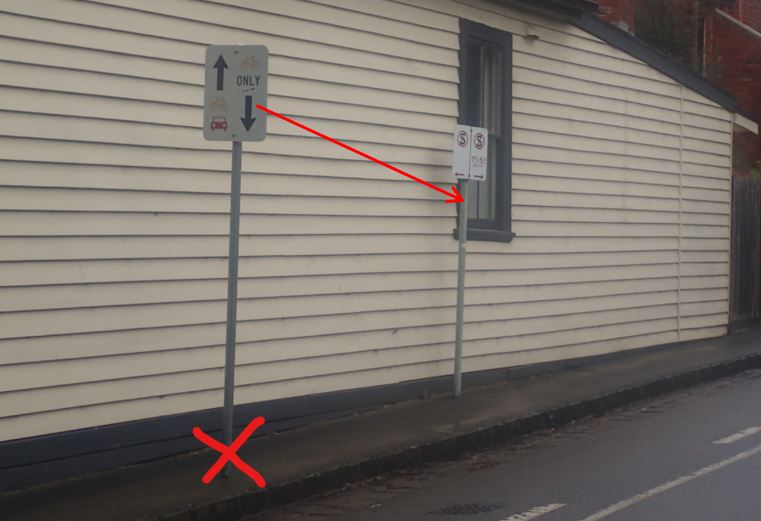
Yambla St North
This section runs between parklands and houses and has streets and lanes entering it from the West. It has only one narrow (1.15m wide) footpath on the west side, and even this narrow path is interrupted by signs, and the rough kerbs and cobblestones of entering streets. Repeated from above by ZM: “This section of Yambla (between Ramsden and Wright st) is very busy with families and kids to and from school. The footpath however along this part of the street is very narrow and tricky to walk. As a parent of a preschool aged kid, we are often walking with scooters or a bike, and it is not possible to ride easily along this route. Also, in some parts the poles get in the way making it impossible to walk beside my child holding their hand. It would be great for the council to consider widening this footpath. I have highlighted this issue on my blog.
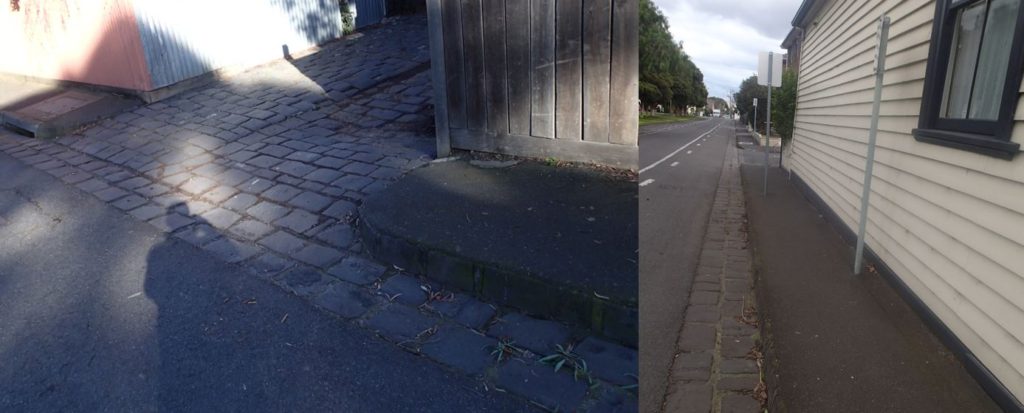
Images: Stephen Nurse
Another help for this section would be to run a gravel walking path in the parkland next to Yambla Street in this section. This path is covered in the Hall Reserve section of this page.
Kiewa and Aitken Streets
Aitken Street runs directly into Kiewa Street, with a small pocket park acting as a restriction to stop through car traffic from Kiewa into Aitken and vice versa. Cyclists can still get through this restriction on-road, as there is a narrow path left open. This is good! Even though there is traffic both ways, car traffic is quiet because of restrictions including the narrowness of the streets, and the quiet street makes for good cycling.
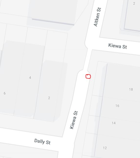
There could be an improvement though, on occasions, cars are parked in Kiewa Street within 2m of the pathway between Kiewa and Aitken, and cyclists must dismount to proceed along the route (the parked car shown below is marked as the red circle on the map above).
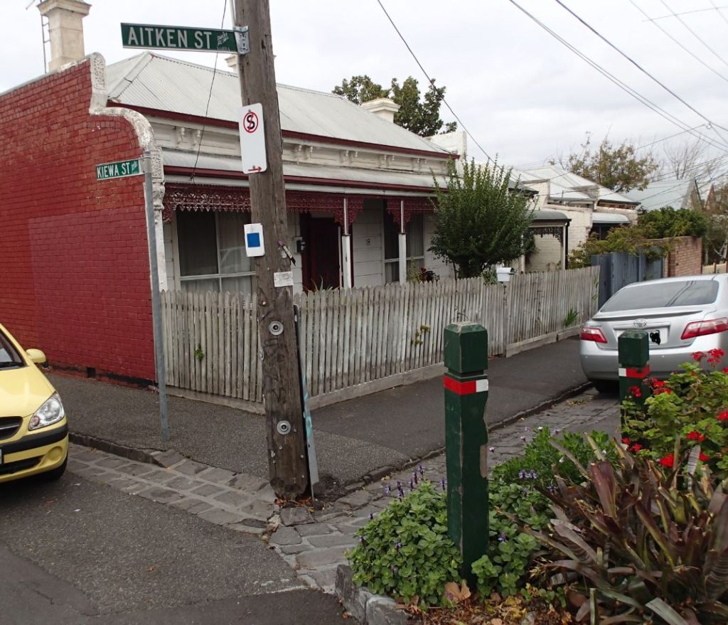
A barrier to prevent car parking within 3m of the restriction would prevent the carparking and remedy the issue. Existing barriers in the area include trees inside steel hoops, and one of these barriers would do the job.

The small pocket park is used by the community and has a small basketball hoop. We’d welcome neighbours’ suggestions on improving the pocket park.
Conclusion
This page proposes many ways to improve the streets of East Clifton Hill.
Local champion
Your local champion for East Clifton Hill LAPM 6 is Steve Nurse. You can contact Steve at cesnur(the at symbol)iimetro.com.au. View all of Streets Alive Yarra’s champions on our supporters page.

Streets Alive Yarra are pushing an agenda of what our cities should look like. We simply don’t have the space for everyone to have cars, for everyone to go as fast as they like in those cars, and for everyone to stay safe and well. I enjoy the discussions and notices of meetings.
Steve Nurse