Brunswick Street is a great shopping strip and can be even better.

Context
Brunswick Street is a north-south tram-based shopping street in Fitzroy, changing to St Georges Road as it heads north-east to Merri Parade. Brunswick Street forms the core of Local Area Place Making (LAPM) precincts #11 Fitzroy and #9 Rose, while above Alexandra Parade it forms the border between LAPM #3 Scotchmer and #4 North Fitzroy.
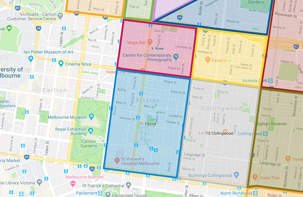
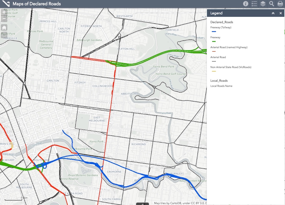
Brunswick Street south of Alexandra Parade is 100% controlled by Council – it’s not a VicRoads road. North of Alexandra Parade it is a declared road controlled by VicRoads.
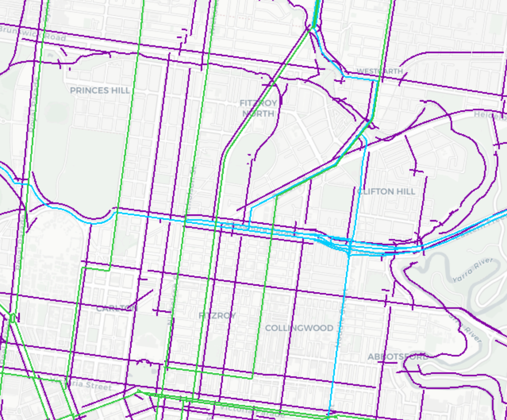
The entire length is a ‘Tram Priority Route’ (green in the image below) and part of the ‘Principal Bicycle Network’ (purple in the image below). None of the length is designated as a ‘Preferred Traffic Route’ (blue in the image below).
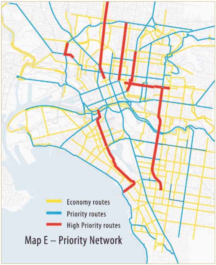
Brunswick Street is also an Inner Melbourne Action Plan (IMAP) ‘high priority bicycle route’, as shown in the Yarra Bike Strategy 2010-15:
Brunswick Street south of Alexandra Parade is defined by the Yarra Bike Strategy as ‘Priority A’ and ‘Priority B’:

Issues and options
The issues with Brunswick Street are:
- lack of level-access tram stops;
- lack of safe (protected) bicycle lanes;
- lack of street trees; and
- narrow footpaths.
Elephant in the street
The ‘elephant in the street’ is on-street parking. If we’re able to relocate shopper parking to the first 5-10 bays on each side street, then we free up a lot of space that can be used to revitalise the street.

Movement & Place and Safe System
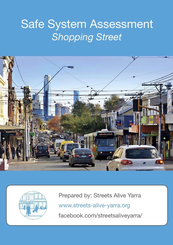
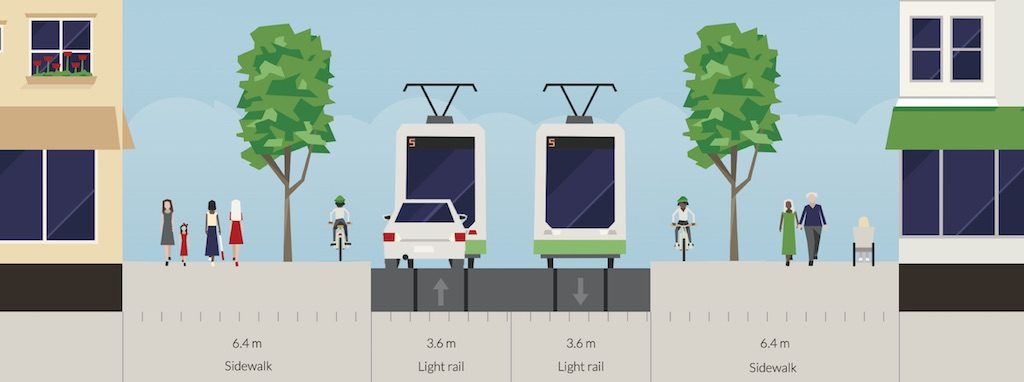
Movement & Place and Safe System are VicRoads assessment frameworks that offers guidance on how to allocate street space to different modes and how to design streets to prevent death and serious injury. Streets Alive Yarra has conducted both Movement & Place and Safe System assessments of a 20-metre wide tram-based shopping street, concluding that a street layout similar to the one shown above is the best solution, because it delivers the highest ratings for each of the three factors: Movement, Place and Safety. Links to the reports are:
Proposals
Brunswick Street is roughly 20m wide, from shop to shop, which is enough space for a 6.4m wide footpaths to support more trees and cycling lanes. Cars would drive behind trams, slowing the street and (combined with more trees) making it more attractive for walking, lingering and footpath dining.
You can download our full submission:
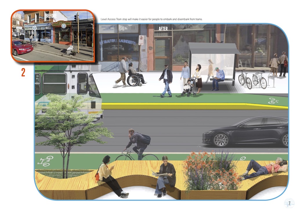
Hannah Pastrana has examined Brunswick Street and prepared a proposal (download full PDF) with level access tram stops and protected bicycle lanes:
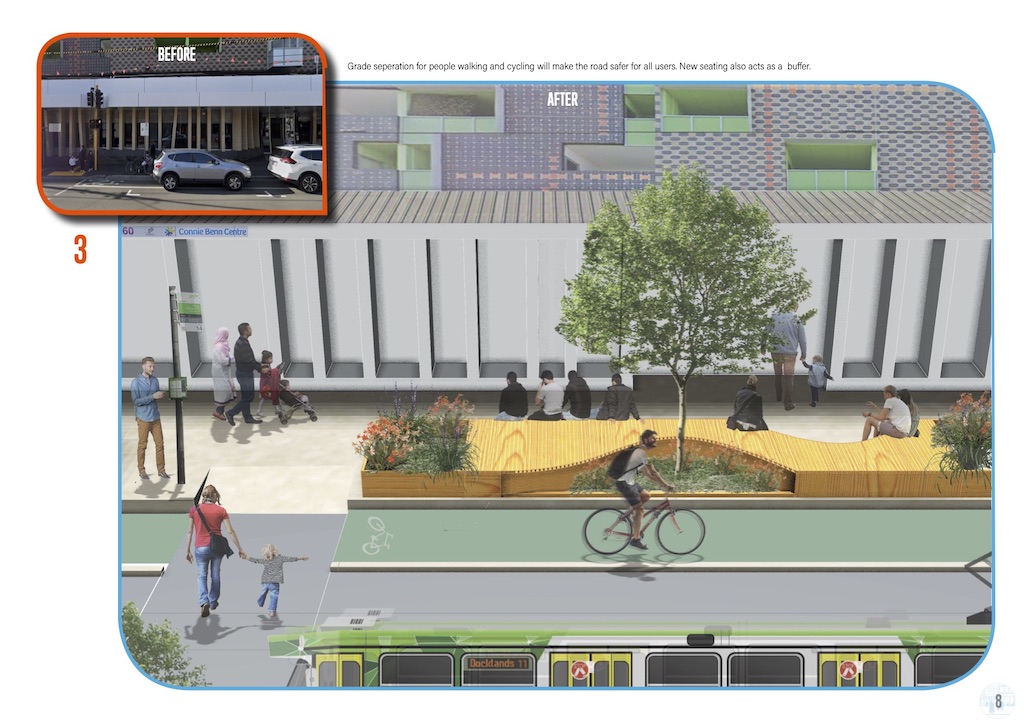
Redesign by Mikael Colville-Andersen
Mikael Colville-Andersen, founder of the Copenhagize Design Co., and presenter of The Life-Sized City, has taken a look at Brunswick Street:
Trial of level-access tram stops
Brunswick Street offers a unique opportunity to leverage the great work of the City of Moreland and VicRoads/DoT regarding a trial of protected bicycle lanes on Sydney Road. VicRoads/DoT managed a two year consultation with the Council, community and traders, with the outcome that the City of Moreland voted to support a trial on a section of Sydney Road. The State Government deferred any trial until after the Level Crossing Removal project on the Upfield Line has been completed. However, the extensive work completed to date deserves a trial on a tram-based shopping street, somewhere in Melbourne.
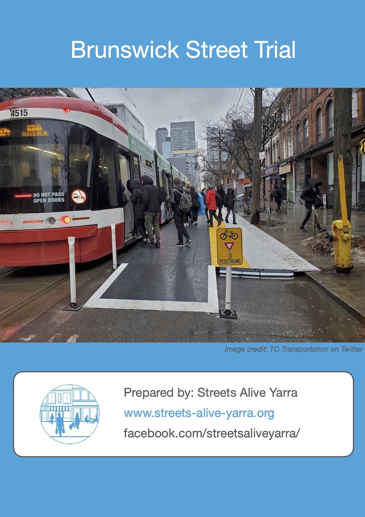
This means that we in the City of Yarra have an opportunity to offer Brunswick Street as a location for a trial, with funding sourced from the DoT and TAC. The trial could use low-cost relocatable level-access tram stops, as demonstrated in Toronto:
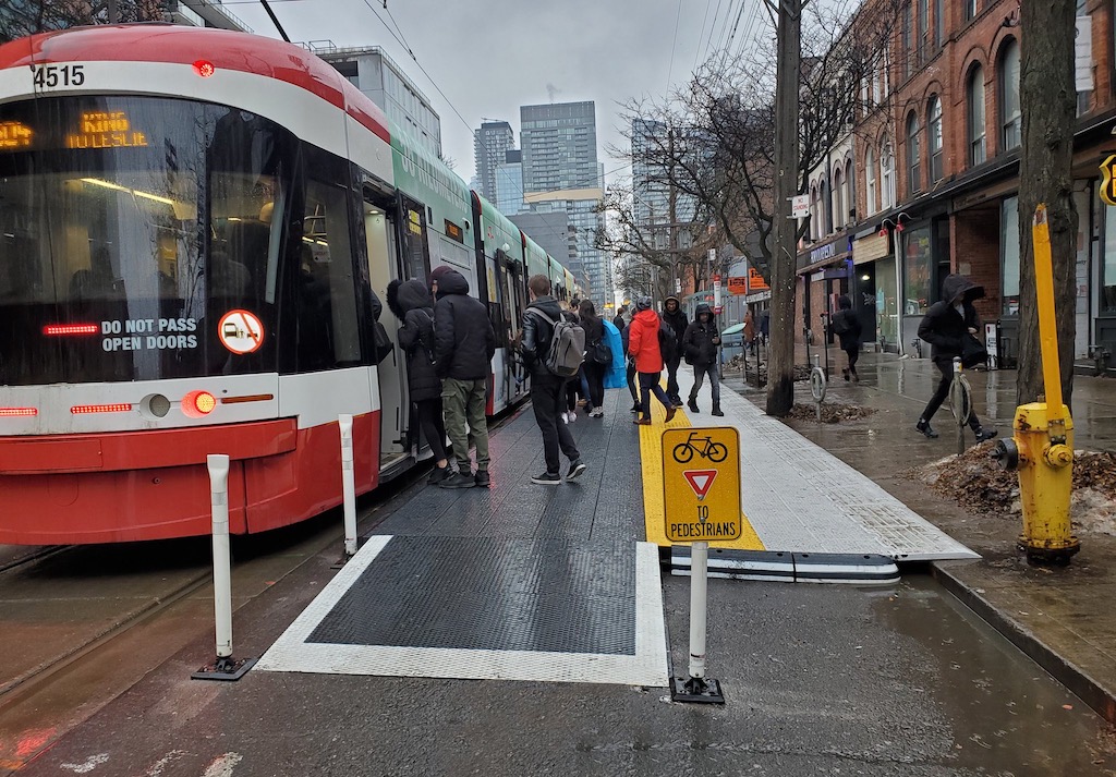
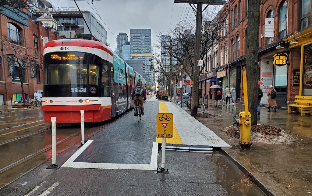
You can download our proposal for a trial in Brunswick Street:
Design guides
Learn more from this collection of design guides, including David Mepham’s guide (commissioned by Victoria Walks) to improving Main Streets:
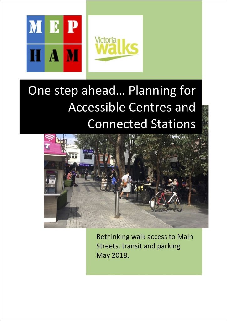
Safety on Brunswick Road north of Alexandra Parade
This section is contributed by John Handley.
For me, the single most important thing you could do to improve accessibility and safety in my area would be to reduce the speed limit to 40 km/h on Brunswick Street from Alexandra Parade to Merri Parade.
Along this strip, you have three primary schools (plus other schools using the crossings), the Edinburgh Gardens and its associated activity centres for young and old, the library, many shops and cafes, many pedestrians and cyclists, including many small children walking and cycling independently, and parents (usually Mums) with a kid in a trailer or on a cargo bike or kid’s seat.
In spite of the speed restrictions at school hours, cars and trucks are often speeding. If you want to make this area “people-friendly” then speed reduction is the first step.
I am aware that it is a VicRoads road, and that they will resist such a push. And yet Nicholson, the lower part of Brunswick, Rathdowne, and High Street are all 40 km/h zones. By contrast Bell Street is 60 km/h – the same as Brunswick St in this area! How does that make sense?
I am also aware that many residents have been pleading to Council and to Vicroads the same for years. Time to stand up to VicRoads, and get this done as a matter of urgency.
Thank you for listening.
Local champion
Your local champion for Brunswick Street is John Handley, Yarra resident. View all of Streets Alive Yarra’s champions on our supporters page.

I work on Brunswick St. I am a pedestrian, tram user, cyclist, and car driver. My job includes talking to locals and assisting them to move around safely. Everyone I speak to has had incidents with speeding traffic, red-light running, and both car drivers and cyclists flagrantly breaking road rules and placing other road users (i.e. pedestrians) at risk.
John Handley

