Richmond Primary School is located in Local Area Place Making (LAPM) area 21 Barkly.

School support for walking and cycling
The school encourages children to walk or ride to school by supporting the Walk to School and Ride to School programs.
Issues
However, the local set of streets, within 2 km of the school, are not safe. This can be seen by the fact that Yarra Council pays for crossing supervisors on several intersections near the school, similar to other services across Victoria. Also, many parents are reluctant to let their children ride on the local roads.
Solutions
The streets around Richmond Primary School need to be safe, walkable, and bikeable, enabling school children to walk and ride to school without risking death or serious injury. We need to widen footpaths, add safe crossings, reduce traffic speeds and volumes, and build protected bike lanes. In particular, Mary Street would be ideally suited to hosting a protected bicycle lane, as it links the Yarra bike path to the school as well as the Barkly Gardens park. By going through the park, cyclists could join up to the Coppin Street bicycle lanes, leading up to Richmond High School.
Access from the Burnley Pocket
The Burnley Pocket is a residential area to the east of Richmond Primary school, outlined in blue in the image below, with the two options for walking or biking to school shown in red. The two routes are also used by parents and children who live just north of Swan Street, who cross over the railway line using the Burnley Street bridge or the Burnley Station underpass.
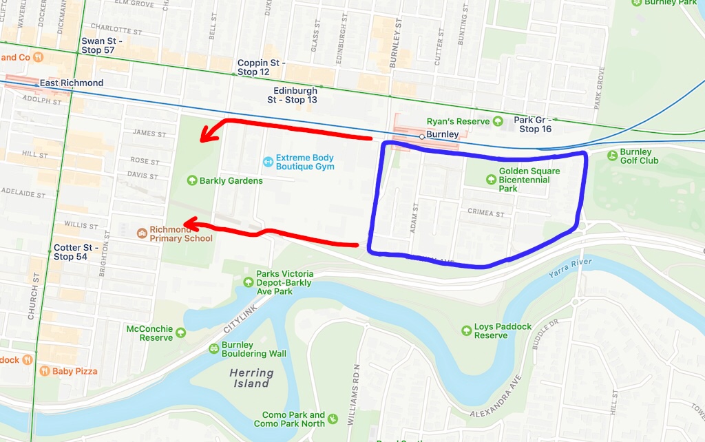
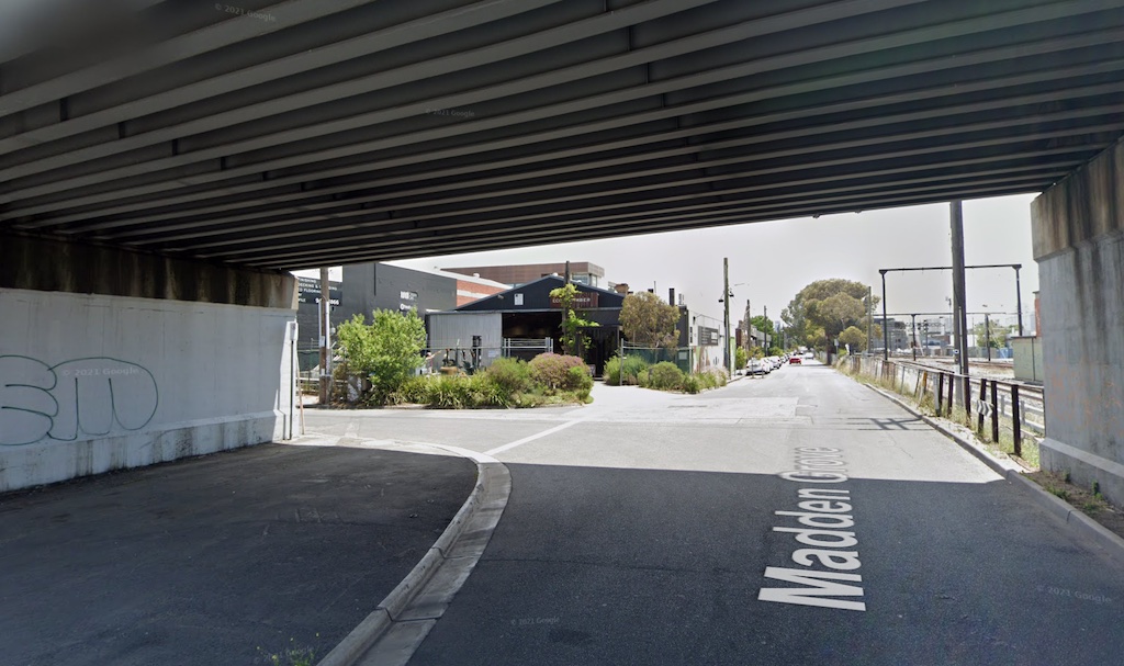
On 15th February 2022, local resident Elena Pappas asked a public question at the council meeting, about what council could do to provide safer routes to school. The northern route is along Madden Grove and passes under the Burnley Street bridge. There are no pedestrian or pram friendly crossings under the bridge, to cross the Burnley Street slip lane.
The southern route, along Barkly Avenue, has a crossing at Burnley Street that is often blocked by trucks, and the signalised crossing time is too short for small children. The traffic islands are too small to accomodate bikes and prams.
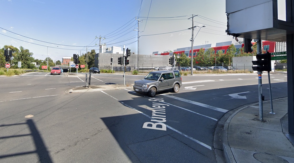
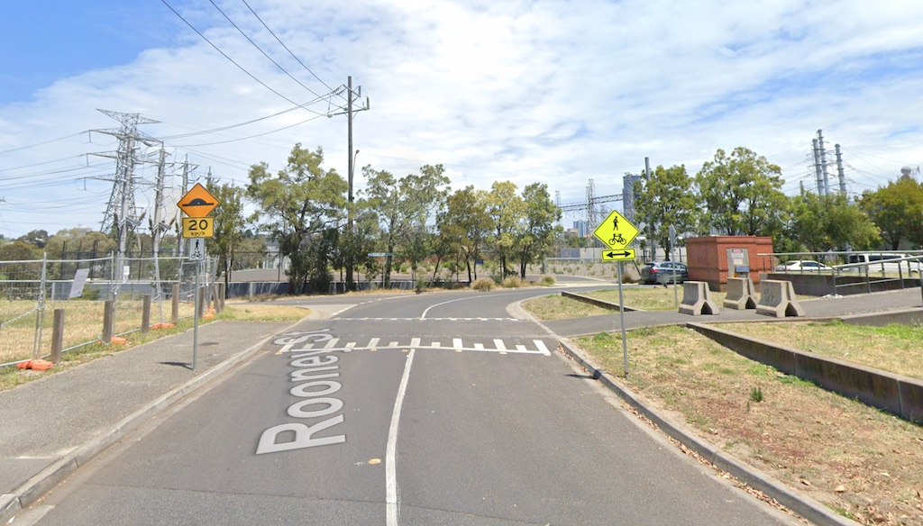
Continuing along the southern route, at Rooney Street, the raised speed hump is not a pedestrian crossing, and the path is blocked by bollards.
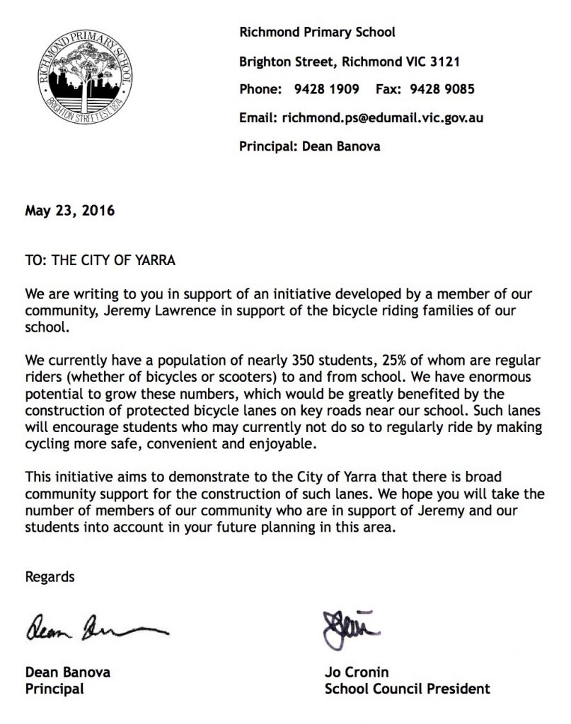
Support from the school
In 2016, the Richmond Primary School Principal and School Council President supported the call for safer streets:
Local champion
Your local champion for Richmond Primary School is Saskia, a student at the school, who led the collection of a petition from students, calling for safe routes to school. View all of Streets Alive Yarra’s champions on our supporters page.
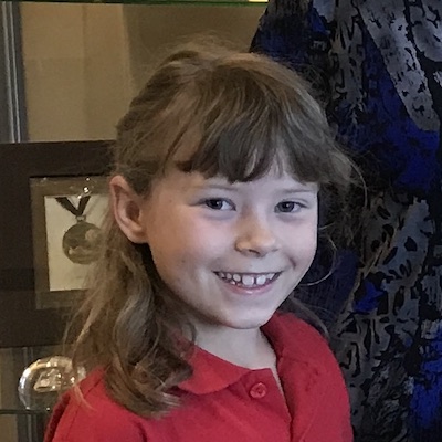
I don’t want to get run over by some fast cars and you probably don’t want that either. You can stop this from happening by making the cars go slower and make a safer bike paths too.
Saskia