Maps can help identify gaps in services
Streets Alive Yarra maintains several maps.
Play spaces
View our full page on play spaces.
Modal filters
View our full page on modal filters.
Parklets
View our full page on parklets.
Shared zones
View our full page on shared zones.
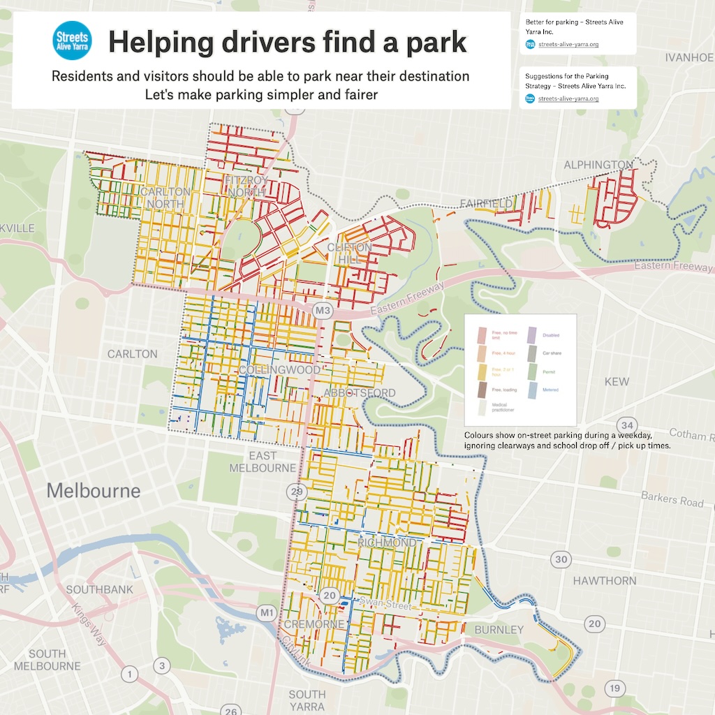
On-street parking restrictions
Click on the image to open the online map.
Allocation of space
Learn more about Yarra’s poor allocation of space:

Crashes
VicRoads (Department of Transport and Planning) maintains a map of crashes:

How you can help
You can help by appearing on the Streets Alive Yarra website as a champion for your local street, neighbourhood, or school.