
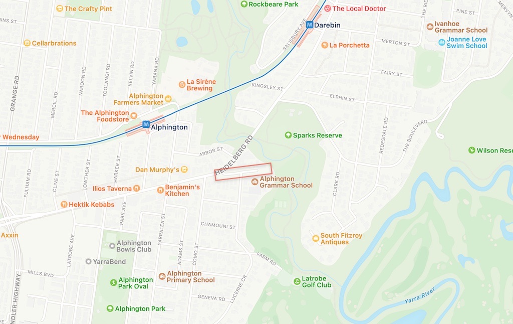
Old Heidelberg Road is an east-west access road in Alphington:
Access to public land
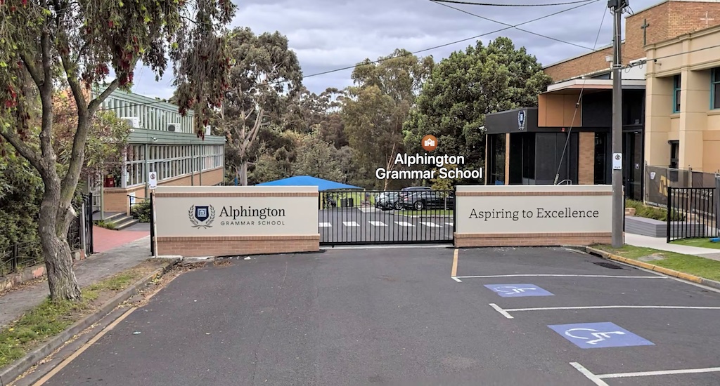
The main issue regarding the road is retaining public access to the full extent of the public road reserve. An adjoining private land owner has built gates across the road and the footpaths, which prevents public access to public land. Council has stated that the gate was installed illegally.
History
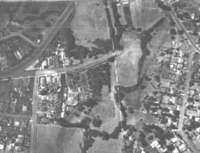
Local residents used to be able to access public land along Darebin Creek via Old Heidelberg Road and the public road reserve. This photo is from 1946, showing an established road on the public road reserve:
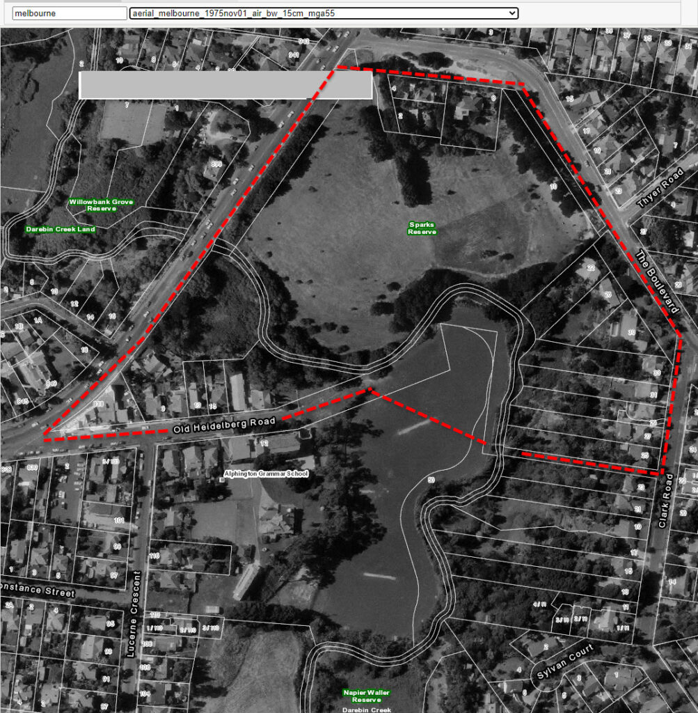
This aerial photo is from 1975, showing the path of a charity fun run that started and finished at the old Parade College in the 1980s. Darebin Creek was crossed using a cast iron bridge that later was washed away.
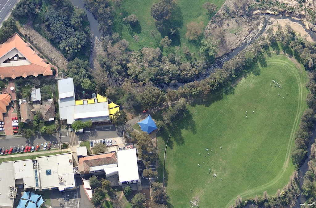
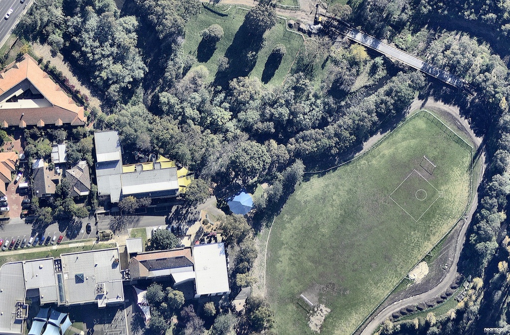
This photo from 2013 shows access for motor vehicles along Old Heidelberg Road and around near Darebin Creek; as well as private structures constructed on the public road reserve.
Public vs private land
Council’s records confirm that discussions between Council Officers and the [owners of adjoining private land] took place in 2005 following a request about the possibility of Council investigating the potential discontinuance and sale of the eastern portion of Old Heidelberg Road. Records note that the matter was never progressed.
Agenda of Council Meeting – Tuesday, 5 October 2021
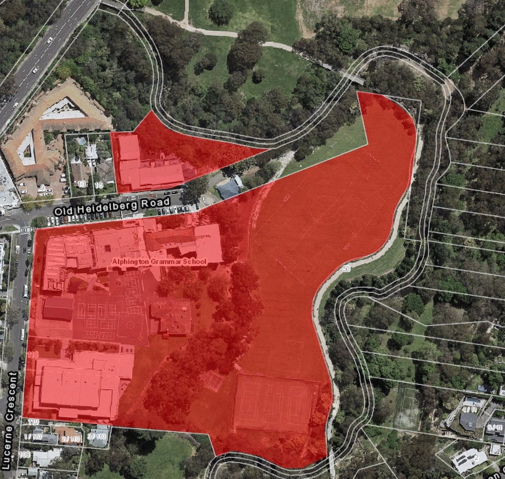
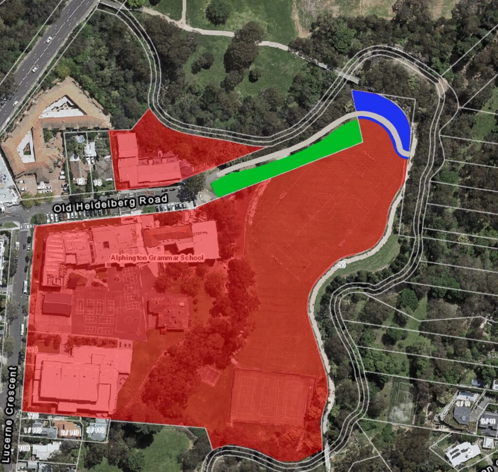
Adjoining private land is highlighted in the image below. The public road reserve extends from the asphalted end of Old Heidelberg Road, down to Darebin Creek and almost to the Darebin Creek Trail. Structures have been built on the public road reserve, including gates, a playground, and part of a sports field. By building such structures, the private land owner is appropriating public land. Council has an obligation to defend public land from appropriation by private organisations.
Guidance from experts
The Victorian Local Governance Association (VLGA) commented on the issue of public versus private land:
If you’re a local resident, I would have thought access to that pristine river frontage would be highly valued and heaven forbid that a council would act in the interest of its local residents…there’s sometimes a need to just lay down a marker and for the council not to be a pushover in terms of its right to public land.
VLGA Connect Episode 276, 27th May 2022
Community interest
It’s in the community interest:
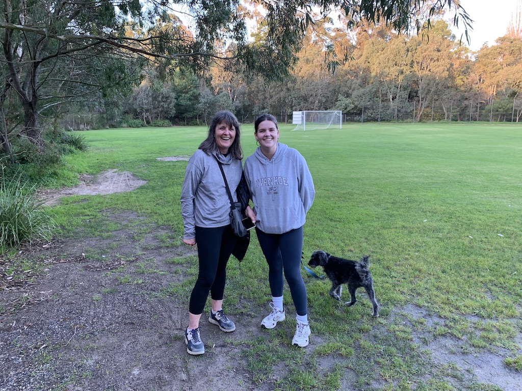
- For members of the public to be able to access public land alongside Darebin Creek, so they can view nature.
- For members of the public to be able to access sports fields on the grounds of schools (outside of school hours) that receive public funding.
- For all levels of government, including local, to defend public land from appropriation by private organisations, because if they don’t, they can create a precedent that leads to further appropriation in other locations.
In addition, local residents would like to access the Darebin Creek Trail from Old Heidelberg Road, which would align with policies of federal, state, and local government that support physical activity in 20-minute neighbourhoods. For this to be possible, access is required across private land. While this access is negotiated, it’s in the community interest for public access to be retained to all areas of public land.
VicRoads assessment
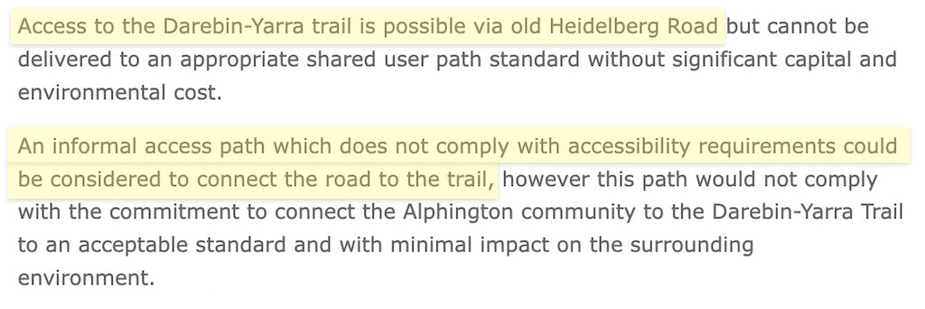
VicRoads examined a connection at Old Heidelberg Road as part of the Alphington Link project. They concluded that an informal access path is possible, but that it wouldn’t meet their project aim of a ‘shared user path standard’ without significant cost, so they selected a lower cost option at Farm Road. It’s unclear whether this assessment assumed that the route would duck under the bridge (using public land), or curve around the top of the sports field (which would cross private land).
Our view
It would be low cost and technically simple to construct a gravel path to deliver access from Old Heidelberg Road to the Darebin Creek Trail. Indeed, such a path existed in 2015 to support the construction of the Darebin Creek Trail.
A similar path could be constructed again if an appropriate land swap could be negotiated, e.g. green for blue, which could be a win-win for the public and for the adjoining land owner.
Way forward
Streets Alive Yarra suggests the following way forward:
- Agree on the basic facts of the matter, including the location of property boundaries
- Formalise a temporary licence allowing the private land holder to close the gates at certain hours of the day, e.g. between 9 am and 4 pm on week-days until 31st December 2022, while further agreements are negotiated
- Negotiate a land swap between government and the adjoining land owner that enables the land owner to retain some structures (e.g. the full area of the marked sports field) and enables council to construct an access path to the Darebin Creek Trail
- Build a fence along the new boundary line (if desired by the land owner), and build an access path between Old Heidelberg Road and the Darebin Creek Trail (e.g. following the route of the 2015 vehicle access path used for constructing the Darebin Creek Trail)
- Remove the brick wall that blocks the road, remove the gates that block the footpaths, and return the management of on-street parking to council
- Implement traffic calming measures to reduce hazards during drop-off and pick-up times, e.g. identifying locations slightly away from the school where students can be dropped off to walk a short distance to school
Estimated costs:
- $2,000 for a surveyor,
- $0 for the land swap, and
- $5,000 for gravel (laid by volunteers).
How you can help
You can help by appearing on the Streets Alive Yarra website as a champion for your local street, neighbourhood, or school.