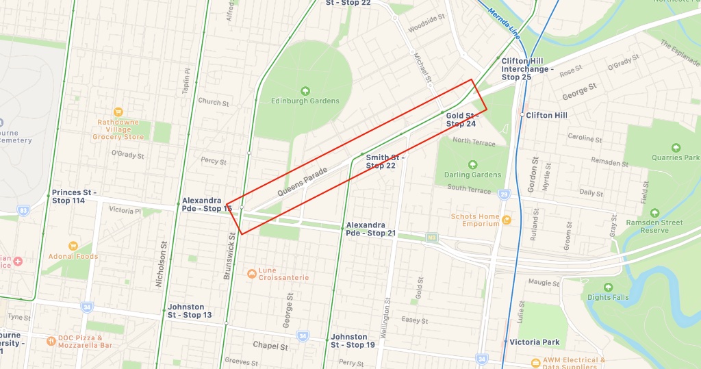
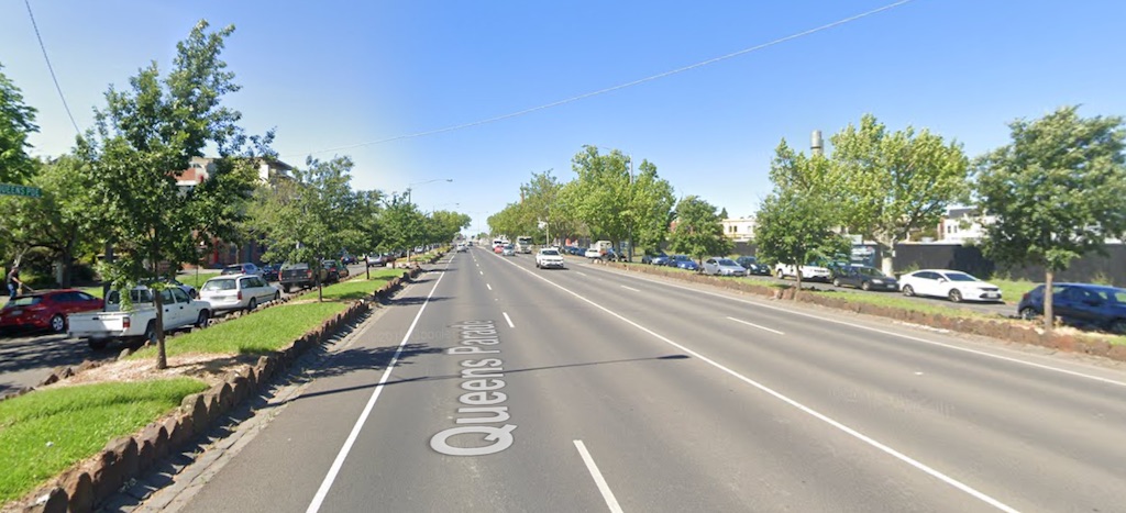
Queens Parade is a wide boulevard running north-east through North Fitzroy (LAPM #4) and West Clifton Hill (LAPM #5). In most places it’s four lanes wide, with a service lane running in each direction as well.
Lower Queens Parade
This page is contributed by our local champion, Tim Cameron.
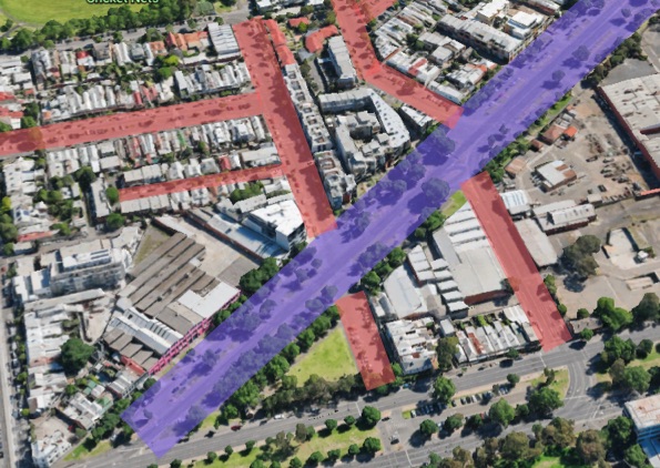
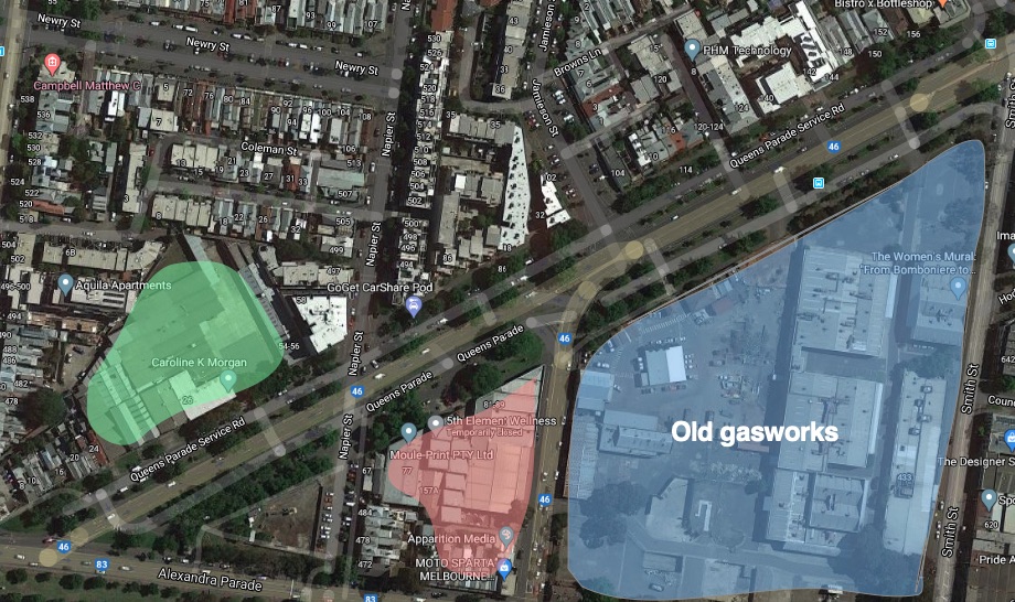
For the time being, I’ll just focus on the relatively small section of Queens Parade between Brunswick Street and Jamieson Street. At the lower end of Queens Parade each service lane has parallel parking each side, for a total of four lanes of parking. All these driving and parking lanes result in a 40 to 50 metres wide boulevard, with a huge amount of land dedicated to cars. Just how much land becomes clearer to see when you highlight the area dedicated to the road. Queens Parade is highlighted in purple below. Other Fitzroy North roads, some of them quite wide in their own right, are highlighted in red.
Traffic
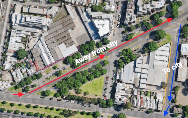
Because traffic can only enter the lower section of Queens Parade off Alexandra Parade near the corner of Brunswick Street, traffic travelling east along Alexandra Parade turns off into Queens Parade. Traffic travelling down the upper section of Queens Parade to the city or west across the city has to turn down George Street to enter Alexandra Parade so misses the section of Queens Parade below Jamieson Street. On a census day at the corner of Queens Parade and Jamieson Street in 2010, 9000 cars were counted travelling north-east and just 740 travelling south-west.
Expected development
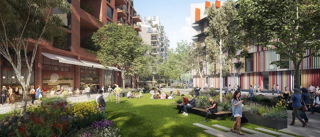
The lower part of Queens Parade is going to see a lot change in the coming years. The areas highlighted in the image below will all see large multi-storey residential towers. The old gasworks is slated for 1,100 apartments, a 650 student high school and a chunk of retail. On top of this, there is also a proposal for a 52 metre residential complex on the north-east corner of Smith and Alexandra Parade.
Proposals
With so many more bodies living and travelling to the area, Yarra has a great opportunity to promote active transport modes, and foster a real sense of community in the area.
Queens Parade Reserve
In the images above you’ll see a small triangle-shaped park called Queens Parade Reserve. Given the proximity to Edinburgh Gardens, and as with many parks sandwiched between two busy roads, I rarely see anyone ever make use of the park. I daresay the community can make better use of it in some other form. Perhaps some sporting facilities, or an enclosed childrens’ playground ready for the population explosion the immediate area is going to experience in the coming decade.
Queens Parade service lanes
In the lower section of Queens parade, the road footprint should be narrowed to 30 metres or less, and the rest of the land given back to promote active modes of transport and to the community. Some land could also be used for high density residential properties.
Queens Parade parking restrictions
Yarra will have to introduce parking restrictions along the lower end of Queens Parade, given most parking is currently unrestricted. This will mean that residents in the area will have to purchase parking permits for the first time. Yarra should consider current residents and their current ability to park, but they shouldn’t price permits too low. The two storey carpark in my apartment block is only two-thirds full as some residents park in the service lane for ease. Yarra should price permits at a level that more closely reflects the benefits that users receive.
Space for car sharing
Currently, a lot of cars parked on the Service Road long term are listed on car sharing websites. They should be given a preferred arrangement so they can continue to provide a service that helps others minimise the need to own private vehicles.
Space for cycling
Most cyclists’ only experience with the bottom part of Queens Parade is crossing it on their ride along the very busy Napier Street on-road cycle lane. Crossing Queens Parade is likely to be one of the least pleasant tasks on a ride home north up Napier Street given the width and complexity of Queens Parade, and the relatively fast moving traffic speeding north-east. Crossing Queens Parade southbound, the typical morning route into the city, is a lot easier for cyclists as there is much less traffic on that section.
In 2018 a plan was announced to implement ‘new traffic lights at the intersection of Napier Street and Queens Parade and closing the east and west service lanes’. This would have made crossing Queens Parade less intimidating for people cycling. Some valid feedback was that traffic lights aren’t needed and that they will add even more time to cyclists’ commute.
The current plans listed on Vicroads say there will be more traffic islands between Newry Street and Alexandra Parade. It no longer talks of shutting off the service roads from Napier, something that would greatly reduce the complexity of the crossing.
Local champion
Your local champion for Swan Street is Tim Cameron, Yarra resident. View all of Streets Alive Yarra’s champions on our testimonials page.

I spent time living overseas in a high density neighbourhood about 5 km from the city CBD and my local neighbourhood felt alive. Kids walked to school, and local pubs were full of locals. Since returning to Melbourne I can’t help noticing how our lives revolve so much around the car. We dedicate so much space to cars and, given ‘density’ is a dirty word, it doesn’t seem like that will change any time soon. While Melbourne is one of the best cities for cycling in Australia, there is so much more we can do to make active transport appealing to people of all ages. Streets Alive Yarra promotes sensible local government policies that make walking and cycling attractive to people from all walks of life.
Tim Cameron