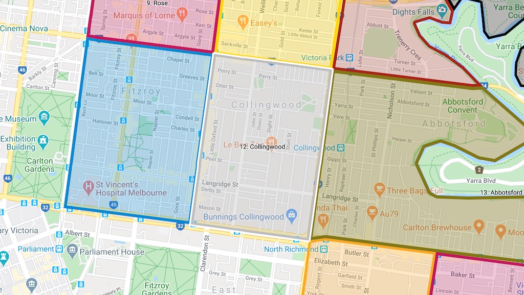
Collingwood is designated as Council’s Local Area Place Making (LAPM) precinct #12, bounded by Johnston Street, Hoddle Street, Victoria Parade, and Smith Street.
Context
Collingwood is a residential neighbourhood, with declared arterials on three boundaries (north, south and east). To the west, Smith Street is the local shopping street, and is not a declared arterial. Within the neighbourhood, north-south movement can occur on Wellington Street, which is calmed to 30 km/h and has protected bicycle lanes.
East-west movement can occur on Langridge Street, which has painted bicycle lanes.

30 km/h zone
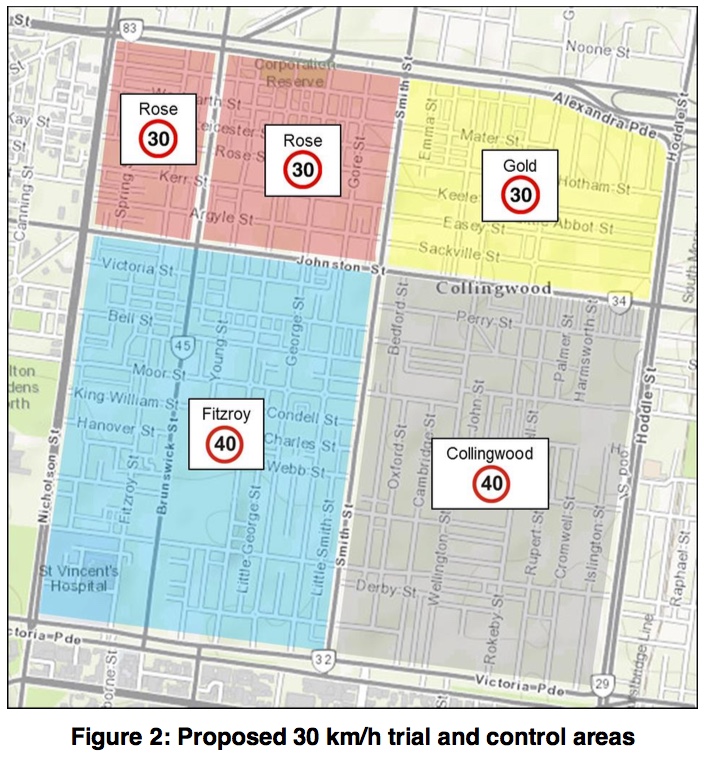
Collingwood is just south of the 30 km/h zone trialled by the City of Yarra.
Previous review
Collingwood was last assessed in 2014-2015. Back then they were called called ‘Local Area Traffic Management’ not ‘Local Area Place Making’. LAPM reviews are a once in a decade opportunity to persuade Council to invest decent money in infrastructure such as a 30 km/h zone, better footpaths, bicycle paths, trees, pocket parks or street closures.

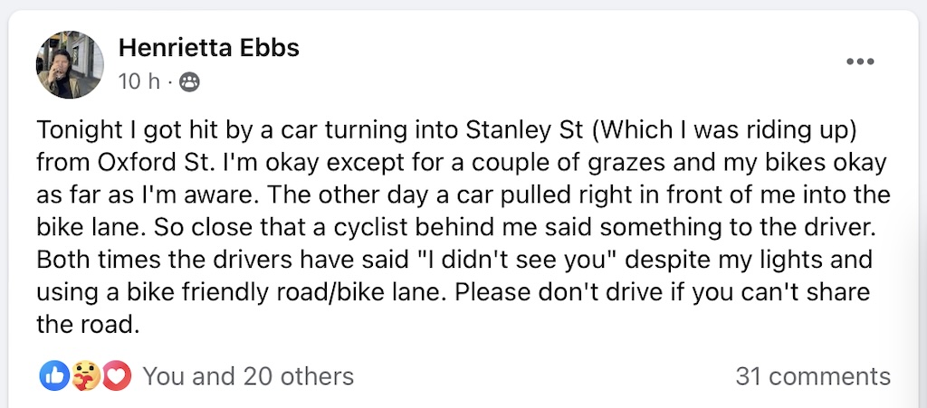
Crash on Stanley Street
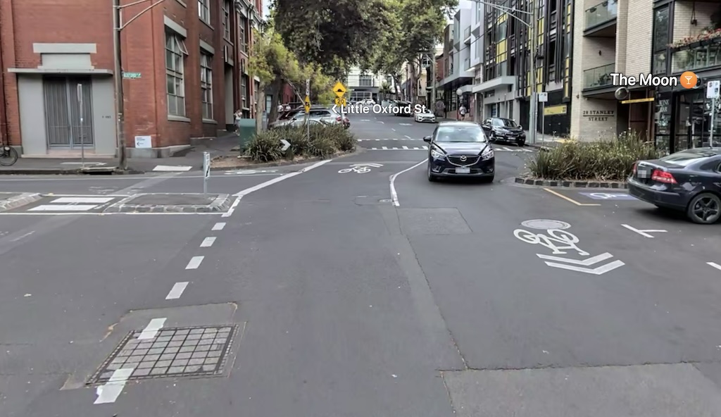
A person on a bike was struck by a person driving a car, while on Stanley Street near Oxford Street. We can reduce the likelihood of such crashed occuring in the future if we expand the 30 km/h trial area to include all of Fitzroy and Collingwood, as council is proposing.
Suggested improvements
Collingwood can become safer and more attractive to live in if the whole area becomes a 30 km/h Low Traffic Neighbourhood.
Local champion
Your local champion for Collingwood LAPM 12 is Henrietta Ebbs. View our champions on our supporters page.

I was riding along Stanley Street in Collingwood. A driver slowed at the intersection, turning left from Oxford Street into Stanley Street and then continued turning, clipping my bike with his car. He stopped about 5 metres after hitting me. When he got out, I could see that he had headphones in and had been on the phone. He also attempted to gaslight me by saying things like, it wasn’t that bad, your bikes fine, you’re fine.
Henrietta Ebbs