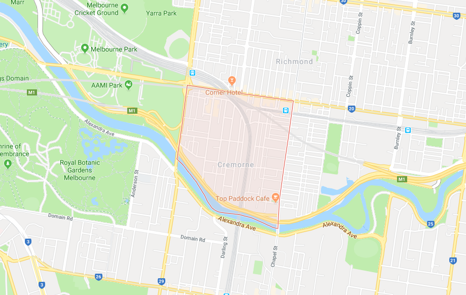
Cremorne is designated as Council’s Local Area Place Making (LAPM) precinct #20 (Balmain), bounded by Punt Street, Swan Street, Church Street and the Yarra River.
Context
Cremorne is an attractive place to live and work because it’s a mixed use area that is very close to the city centre of Melbourne, has a high Walk Score rating of 89, is and is well serviced by public transport.
Problems
Cremorne suffers from multiple problems, including:
- Lack of built form controls
- Lack of public open space
- Severe congestion and rat running
- Narrow footpaths (too narrow for a wheelchair), and lack of protected bicycle lanes
Trends
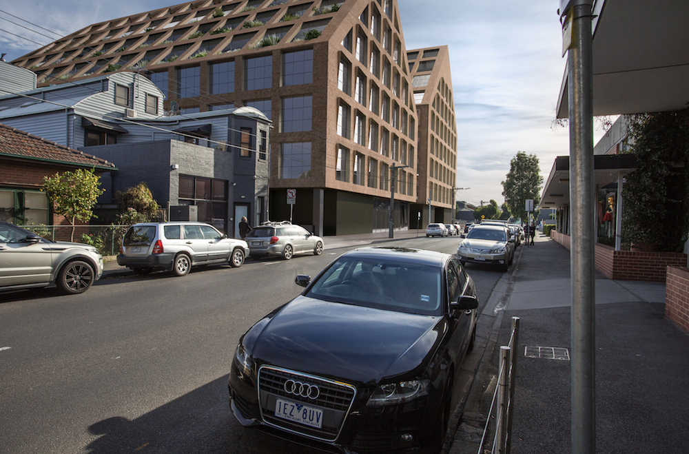
The problems described above will only get worse because Cremorne is booming, with high rise commercial and residential towers being built in many locations.
2007 Urban Design Framework
Council developed an Urban Design Framework for Cremorne in 2007 which recommended built form controls, traffic calming and improved bicycle routes. Unfortunately the Urban Design Framework was not formally adopted into Yarra’s Planning Scheme, so the built form controls were ignored by VCAT.
2013 Local Area Traffic Management study
Conducted a Local Area Traffic Management study of Cremorne in 2013, identifying problems on many streets, such as:
- high traffic speeds & volumes
- poor safety for people walking & biking
The study attempted to “improve safety” by “reducing traffic speeds” and “discourage through traffic”, but only recommended speed bumps, instead of treatments that would actually work, such as modal filters, raised pedestrian crossings, and protected bike lanes.

2020 Cremorne Place Implementation Plan
The Victorian Planning Authority (VPA) published the Cremorne Place Implementation Plan in 2020, which was developed in partnership with the City of Yarra. This is a high level document which helps to align the work of various state government departments, and council.
2022 Urban Design Framework
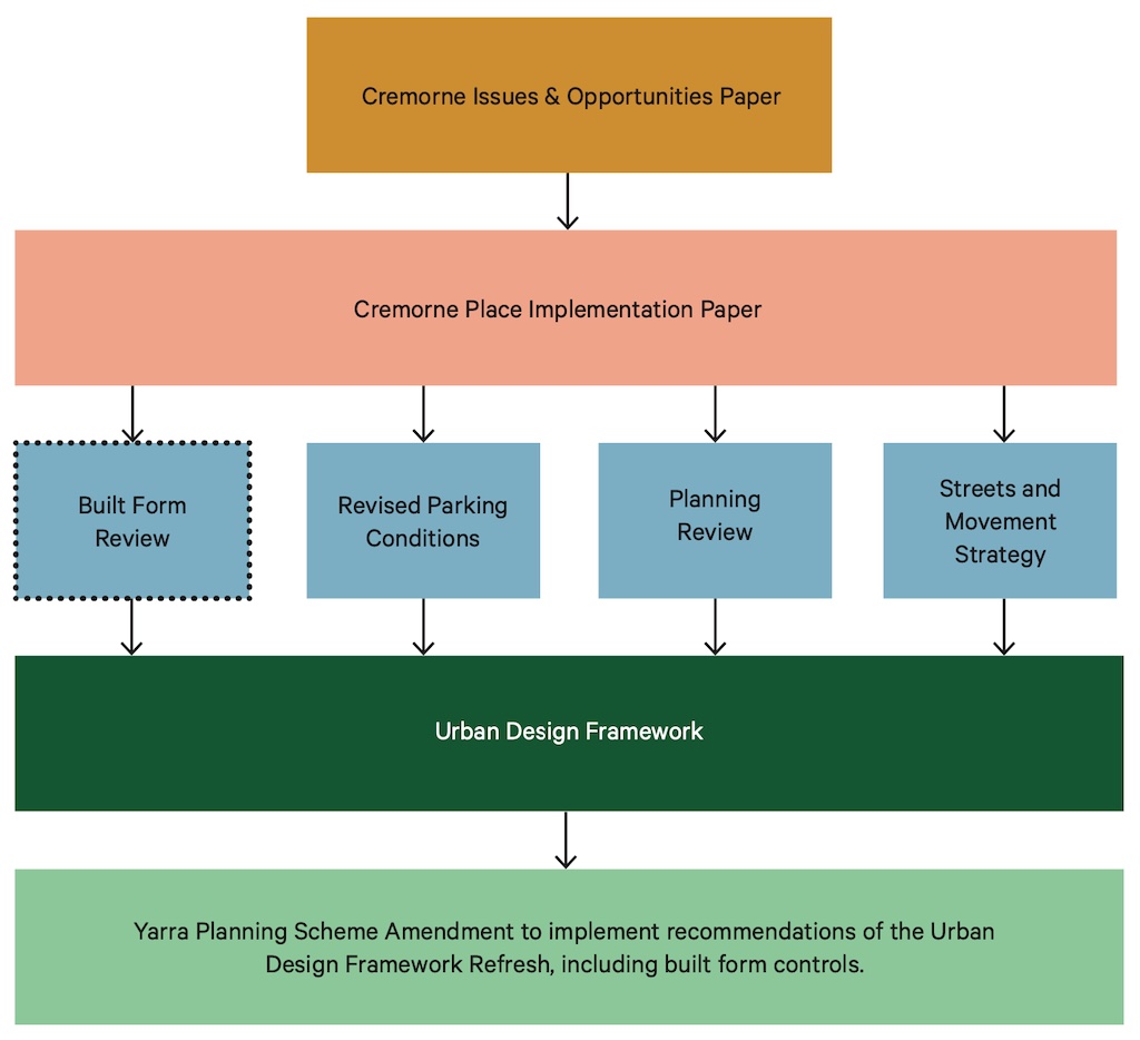
An outcome of the Cremorne Place Implementation Plan was a commitment to prepare a new draft Urban Design Framework:
- Draft Urban Design Framework (Part 1)
- Draft Urban Design Framework (Part 2)
The development of the draft Urban Design Framework was supported by four reviews, which have been obtained from Council via Freedom of Information:
Suggested solutions
There’s lots of information in the reviews and the draft Urban Design Framework. Streets Alive Yarra supports the proposals to:
- Impose built form controls
- Increase public open space
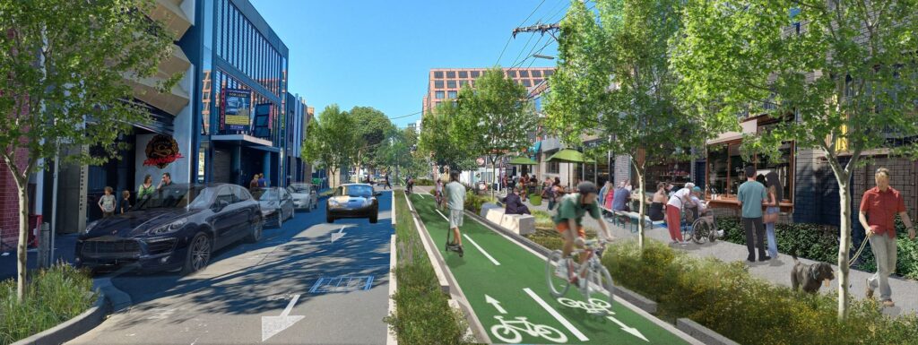
- Calm traffic and improve safe access for people walking and biking
In addition, we suggest:
- Changing many small streets to 20 km/h shared zones, without footpaths or gutters (as recommended by the 2007 Urban Design Framework)
- Making all on-street parking ‘permit only’ and charging visitors to park
- Adding many pedestrian crossings on Cremorne Street and Balmain Street
- Underground power cables to de-clutter footpaths and enable trees to grow properly
- Consider the proposal from Ratio Consultants for a one-way access loop:


Detailed design proposals
Detailed design proposals are available for:
- Balmain Street
- Church Street
- Cremorne Street
- Dunn Street
- Gwynne Street
- Stephenson Street
- Swan Street
- Wellington Street
Funding
Funding can be obtained by pricing on-street parking at market rates, in accordance with Yarra’s adopted Pricing Policy, and Parking Management Strategy.
Further guidance
Further guidance on how to improve cities and neighbourhoods is available in ‘Transforming Australian Cities‘:
Conclusion
Cremorne is a great suburb and can be even better. Development is booming, giving us a wonderful opportunity to trial best practice concepts for urban design, place making and reallocation of street space. Let’s make best possible use of the Cremorne Place Implementation Plan, and transform Cremorne for the better.
Local champion
Your local champion for Cremorne is Alyson Macdonald. View all of Streets Alive Yarra’s champions on our supporters page.

I’m a long time Cremorne resident and have witnessed much change since first moving here in 2000. Love to explore all Yarra’s nooks and crannies on foot or by bike. I now have a primary school-aged child, which puts street safety in a whole new perspective.
Alyson Macdonald